Home
Home
Most ancient cities are remembered for what they built upwards — walls, temples, towers. Madaba is remembered for what it laid down. Beneath its churches and houses lies the densest concentration of Byzantine floor mosaics anywhere in Jordan, and one of the most important in the world.
The town sits about 30 kilometres southwest of Amman on the King's Highway, the trade route that has carried caravans, armies and pilgrims through Jordan for roughly three thousand years. It is not large. It has never been a capital. And yet its name appears in the Hebrew Bible, on a ninth-century BC victory stele, in Byzantine church inscriptions, and in nearly every serious study of early Christian art in the Middle East.
Here's what Madaba actually is, and why its floors matter so much.
What Is Madaba and Where Is It?
Madaba is a historic town and governorate capital in central Jordan, positioned on the elevated plateau east of the Dead Sea at roughly 780 metres above sea level. It lies around 30 km southwest of Amman and approximately 10 km from Mount Nebo, the ridge traditionally identified as the place from which Moses viewed the promised land.
Its ancient name was Medeba — the form used in biblical texts and in Moabite inscriptions. The name has survived, with minor variation, for close to three millennia, which in itself tells you something: the site has almost never been fully abandoned for long.
Three things define Madaba's identity:
- Its position on the King's Highway. The town sat on the north–south artery linking Damascus, through the Jordanian plateau, to the Gulf of Aqaba and onwards to Arabia. Trade routes bring wealth, and wealth pays for art.
- Its Byzantine mosaic heritage. Madaba and its surrounding region contain dozens of surviving mosaic pavements, mostly from the fifth to eighth centuries AD.
- Its continuous Christian community. Madaba has one of the highest proportions of Christian residents of any town in Jordan, a demographic thread reaching back to the Byzantine period and reinforced by nineteenth-century resettlement.
That last point is directly responsible for the rediscovery of everything else, as you'll see.
From Moabite Town to Byzantine Bishopric: A Compressed History
The Moabite and biblical era. Medeba appears in the Book of Numbers and the Book of Joshua as a settlement on the Moabite plateau, contested between the Israelites and the kingdom of Moab. Around 840 BC it was named again on the Mesha Stele — a basalt victory monument erected by King Mesha of Moab and discovered at nearby Dhiban in 1868. The stele records Mesha's claim to have taken Medeba back from Israelite control. It remains one of the most significant extra-biblical inscriptions ever found in the region, and it puts Madaba firmly on the historical map three centuries before the Romans arrived anywhere near Jordan.
Nabataean and Roman periods. By the late centuries BC the town fell within the sphere of the Nabataeans, the traders of Petra, and later passed into the Roman province of Arabia after AD 106. Roman Madaba received the standard provincial urban apparatus — a colonnaded street, city walls, public buildings — though far less of this survives above ground than at Jerash or Amman.
The Byzantine golden age. This is Madaba's peak. From roughly the fifth to the seventh centuries AD, the town was a prosperous bishopric with a dense cluster of churches, and a workshop tradition of mosaic-making that produced work of exceptional quality. The great pavements almost all date from this window.
Islamic and Ottoman periods. Under the Umayyads the town continued, and mosaic production carried on into the eighth century — an important detail, because it shows artistic continuity across the political transition rather than a rupture. Madaba then declined, and by the later medieval period the site was largely deserted, its ruins covered by soil and time.
The 1880 resettlement. In 1880, several Christian families from Karak, to the south, migrated north after local conflict and settled on the ruin mound of Madaba. As they cleared ground and dug foundations for houses and churches, they began cutting into buried Byzantine floors. The mosaics did not need to be discovered by archaeologists — they were found by people building homes on top of them.
Because floors are the most durable part of a building and the least worth looting. When a church roof collapses and walls are robbed for stone, the pavement stays where it is and gets buried under the debris. That debris then protects it. Madaba's long period of abandonment, which looks like a loss, was actually the preservation mechanism — centuries of accumulated soil sealed the mosaics away from weather, foot traffic and reuse.
The Madaba Mosaic Map: The Oldest Surviving Map of the Holy Land
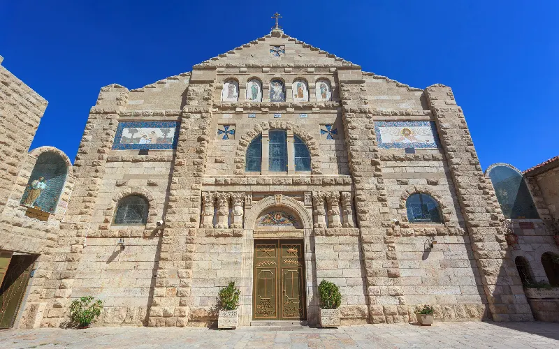
The single most famous object in Madaba lies on the floor of the Greek Orthodox Church of St George.
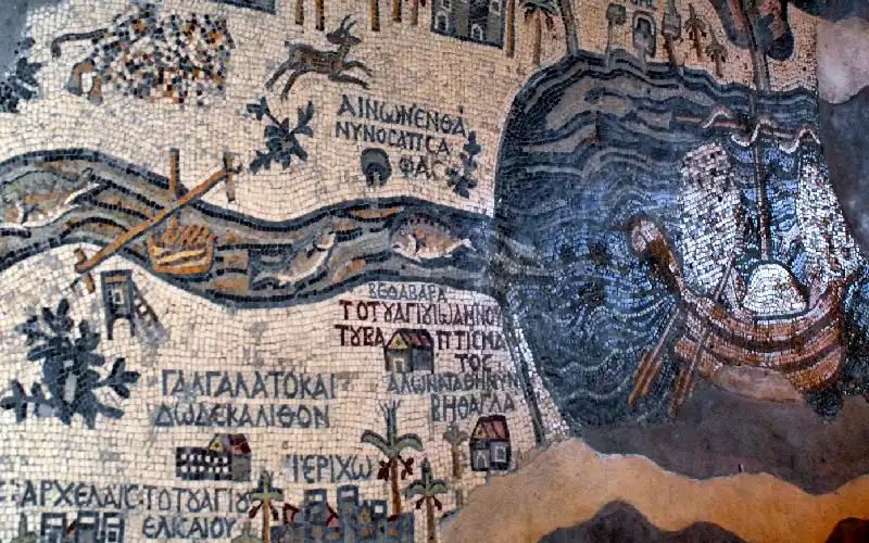
The Madaba Map is a mosaic cartographic pavement dating to the sixth century AD, generally placed between around AD 542 and 570. It depicts the Holy Land and surrounding territories as a geographic panorama — not as a modern survey map, but as a pilgrim's mental image of the sacred landscape, oriented east rather than north.
It was uncovered in 1884 during construction of the new church on the site of a Byzantine predecessor, and brought to scholarly attention in the 1890s.
What it shows:
- The territory from Lebanon in the north to the Nile Delta in the south, and from the Mediterranean coast eastwards into the desert
- More than 150 identified places, each labelled in Greek
- Cities depicted as small bird's-eye views with recognisable buildings, walls and gates
- Rivers, mountains, the Dead Sea complete with two boats, fish in the Jordan River, and a lion pursuing a gazelle in the Moabite hills
Why it matters so much: the map's depiction of Jerusalem is the earliest known representation of the city in this level of detail. It shows the walled city with its gates, its colonnaded main street running north to south, and the Church of the Holy Sepulchre rendered clearly enough to be identified. When archaeologists later excavated in Jerusalem's Old City, the mosaic served as a working reference — a sixth-century image used to interpret twentieth-century digs. Very few artworks anywhere have had that kind of direct archaeological utility.
What survives: the pavement is fragmentary. Estimates of its original dimensions vary, but it is generally reconstructed at somewhere around 15 to 16 metres long by around 6 metres wide, composed of roughly two million individual tesserae. Something in the region of a quarter to a third of the original surface survives today. The losses came from fire, structural collapse and the 1880s building work itself.
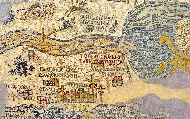
Not in the way a modern map is. It was made for a church floor, and its purpose was theological as much as geographical — to place worshippers inside the sacred landscape and to help pilgrims connect scripture to place. Scale is inconsistent, and importance inflates size: Jerusalem is rendered far larger relative to its actual footprint because it mattered most. What the map is genuinely accurate about is relative position and identification — which settlement lay near which, and what each was called in the sixth century. That is precisely why it has proved so valuable to historical geographers.
Because Byzantine Christian orientation placed east at the top — the direction of the rising sun, of Eden, and of the altar in a church. A visitor standing on the pavement and looking towards the sanctuary would have been looking in the same direction the map itself "looks." North-up cartography is a much later European convention, not a universal one.
Customize Your Dream Vacation!
Get in touch with our local experts for an unforgettable journey.
Plan Your Trip
Beyond the Map: Madaba's Other Mosaic Treasures
The map draws the attention, but it is one item in a much larger inventory. Madaba's mosaic corpus is remarkable for its range — sacred and secular, biblical and mythological, geometric and figurative.
The Church of the Apostles. Its pavement carries one of the most striking figures in Jordanian art: a personification of the sea, Thalassa, emerging from swirling water surrounded by marine creatures. An inscription dates the work to the late sixth century and — unusually — names the mosaicist. Signed works from this period are rare, and the attribution gives us a glimpse of a named craftsman rather than an anonymous workshop.
Hippolytus Hall. Part of a Byzantine mansion within the Madaba Archaeological Park, this floor is entirely secular in subject. It illustrates the Greek tragedy of Phaedra and Hippolytus, alongside Aphrodite and Adonis, personifications of the four seasons, and framed portraits representing cities including Rome and Madaba itself. It is powerful evidence that classical mythology remained part of the visual and educational vocabulary of a thoroughly Christian sixth-century town.
The Church of the Virgin Mary. Built over an earlier Roman structure, its floor centres on an elaborate medallion with a Greek inscription — a masterpiece of geometric composition.
The Burnt Palace. A large residence destroyed by fire, which paradoxically helped preserve its floors under a sealed collapse layer.
Umm ar-Rasas. Around 30 km southeast of Madaba, this UNESCO World Heritage Site holds the pavement of St Stephen's Church, one of the largest and best-preserved mosaic floors in the region. Its borders depict named cities on both sides of the Jordan, and its inscriptions carry dates well into the Umayyad period — direct proof that mosaic workshops continued operating under Islamic rule.
Mount Nebo. The Memorial Church of Moses on the ridge northwest of Madaba contains mosaics of hunting and pastoral scenes of exceptional quality, some dating to the sixth century.
Broadly, subject matter and technique both shift. Roman mosaics of the imperial period lean towards mythological scenes, illusionistic depth and naturalistic shading, often in domestic settings. Byzantine mosaics move towards flatter, more frontal figures, heavier use of symbolic content, denser geometric framing, and — critically — a religious architectural context. Madaba is interesting precisely because it sits on the hinge: works like Hippolytus Hall carry classical subjects in a Byzantine idiom, showing the two traditions overlapping rather than replacing each other cleanly.
Why Madaba Is Called the City of Mosaics
The nickname is not marketing. It reflects three distinct realities.
First, density. Madaba and its immediate hinterland contain a concentration of surviving Byzantine pavements unmatched elsewhere in Jordan. Dozens of floors have been recorded across churches, houses and public buildings, and new fragments still surface during construction work in the modern town.
Second, quality and range. The corpus spans everything from simple geometric borders to complex figurative narrative. The technical standard — the fineness of the tesserae, the subtlety of colour gradation used to model faces and drapery — indicates trained, resident workshops rather than imported labour.
Third, continuity. Madaba did not simply inherit mosaics; it still makes them. The Madaba Institute for Mosaic Art and Restoration, established in the early 1990s, trains craftspeople in both the historic techniques and modern conservation science. Graduates work on the restoration of Jordan's own heritage sites. This is genuinely unusual — most places with ancient art traditions preserve the objects but lose the skill. Madaba kept both.
The practical result is that mosaic work in Madaba exists on a spectrum: sixth-century pavements under conservation glass, twentieth-century restoration patches, and newly made pieces produced in workshops using the same limestone, the same nipping tools and the same setting principles as their Byzantine predecessors.
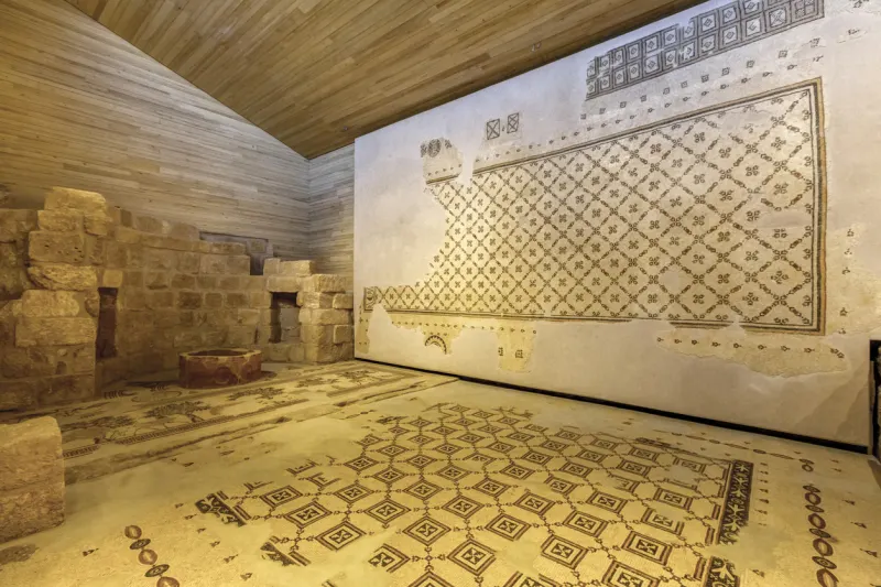
The process was labour-intensive and highly systematic. Craftsmen prepared a layered foundation of rubble, mortar and fine plaster. Coloured stone — mostly local limestone, with harder or imported stone for rare colours, plus glass for brilliance — was cut into small cubes called tesserae, typically around one centimetre square, and much finer for faces and detailed passages. Designs were laid out on the fresh setting bed, and tesserae were pressed in one at a time, with the lines of setting following the contours of the figure to create a sense of movement. A single large church floor represented months of work by a coordinated team. The two-million-tessera figure quoted for the Madaba Map gives some sense of the scale of the undertaking.
Madaba's Landscape, Community and Wider Region
Madaba sits at a geographic pivot point. To its west, the plateau breaks and falls dramatically towards the Dead Sea rift — a drop of well over a kilometre in vertical distance across a short horizontal span. To the east lie the grain fields of the plateau, which have made this region agriculturally productive since antiquity; the Madaba plains are among Jordan's more fertile stretches of land.
That geography explains the town's history. Fertile ground supported population. The King's Highway brought trade. The proximity to sites of religious significance brought pilgrims. Prosperity, route and pilgrimage together funded churches — and churches needed floors.
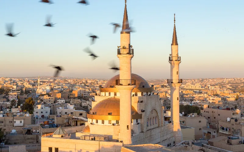
The modern town retains an old quarter of late-Ottoman-era stone houses built by the families who resettled the mound in the 1880s, several of which now serve civic and cultural functions. Madaba's religious composition — a substantial Christian minority alongside a Muslim majority — is often cited as one of the more visible examples of Jordan's coexistence, and the town's church bells and calls to prayer share the same skyline.
Within a short radius sit several of the most significant sites on Jordan's religious and archaeological landscape: Mount Nebo to the northwest, Umm ar-Rasas to the southeast, the Ma'in hot springs in the escarpment towards the Dead Sea, and Mukawir, the hilltop fortress associated with Herod Antipas. Madaba functions as the natural centre of this cluster, which is why the surrounding area is sometimes described collectively as the Madaba region rather than as a set of separate sites.
The settlement has been occupied for roughly 4,500 years, with archaeological evidence from the Early Bronze Age onwards. Its recorded history begins around the ninth century BC, when it appears in biblical texts and on the Mesha Stele as the Moabite town of Medeba.
Yes. Medeba appears in the Book of Numbers and the Book of Joshua in connection with the territory of the Moabites and its allocation among the Israelite tribes, and again in later historical books. It is one of a relatively small number of Jordanian towns named in scripture that still carry essentially the same name today.
Greek. It was the language of administration, liturgy and learning in the Byzantine Near East, and Madaba's mosaic inscriptions use it for place names, dedications, donor records and dates. Later pavements in the surrounding region occasionally combine Greek with other scripts, reflecting the linguistic shift underway after the seventh century.
Through a combination of evidence. The map depicts the Nea Church in Jerusalem, which was dedicated in AD 542, giving a firm earliest possible date. Stylistic comparison with other securely dated pavements, the architectural context of the church beneath St George's, and the political geography reflected in the labelling all narrow the window further, placing it within the third quarter of the sixth century.
Conservation is an ongoing effort rather than a solved problem. The principal threats are moisture rising through the foundations, temperature fluctuation, salt crystallisation within the mortar bed, and physical wear where pavements remain in use. Modern practice favours stabilising mosaics in place with controlled environments, protective walkways and drainage management, and Jordanian conservation teams — many trained locally — carry out continuous monitoring and repair.
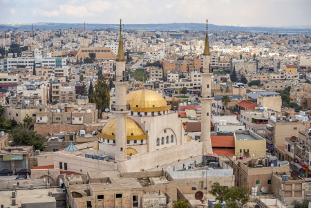


Learn about Jordan attractions, ancient history, and local traditions. Find must-visit places and start planning your unforgettable experience today.
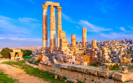
Jordan's capital and largest city, Amman spreads across a landscape of hills with a history reaching back nine millennia — from Neolithic settlement to Roman Philadelphia to modern Arab capital.
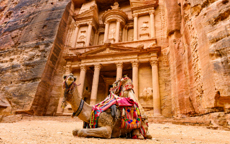
Petra is an ancient city carved into rose-red sandstone cliffs in southern Jordan, once the capital of the Nabataean civilisation and one of the most significant archaeological sites in the world — a UNESCO World Heritage Site and one of the New Seven Wonders of the World.
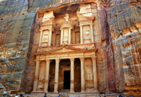
The Treasury (al-Khazneh) positioned opposite the main route into Petra. it was given by the local Bedouin tribes behind the belief that the urn on top of the front entrance contained the treasure of a pharaoh.
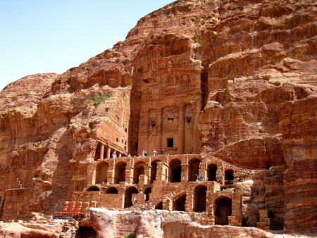
During any trip to Petra, you shouldn't miss the unpredictable Royal Tombs that took its name from the rich decoration. Know More!
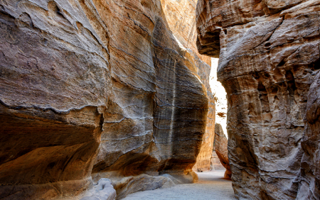
A 1.2-kilometre gorge with walls rising up to 180 metres, the Siq is Petra's main entrance — a natural rock fissure the Nabataeans turned into a processional way and a water system.
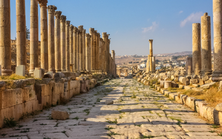
Jerash in northern Jordan is one of the best-preserved Roman cities outside Italy. A former member of the Decapolis league, it retains its colonnaded streets, temples, theatres and triumphal arches after nearly two thousand years.
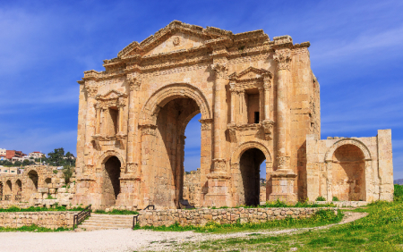
The monumental Roman gateway built to welcome Emperor Hadrian to ancient Gerasa in AD 129 — and still the most dramatic first sight in Jerash today.
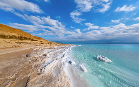
The Dead Sea is a hypersaline lake in the Jordan Rift Valley, sitting around 430 metres below sea level — the lowest point on Earth and one of the saltiest waters in the world. Its mineral-rich water and therapeutic mud have drawn health seekers for thousands of years.
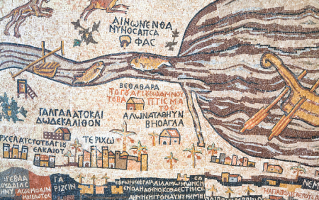
A sixth-century mosaic pavement in Madaba, Jordan, the Madaba Map is the oldest surviving cartographic image of the Holy Land — and the earliest detailed depiction of Jerusalem anywhere.
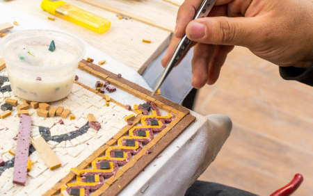
An ancient town on Jordan's King's Highway, Madaba holds the greatest concentration of Byzantine mosaics in the country — including the oldest surviving map of the Holy Land.
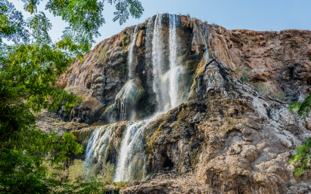
A chain of thermal waterfalls in a desert gorge below sea level, Ma'in Hot Springs has drawn bathers since antiquity — and appears on the sixth-century Madaba Map by name.
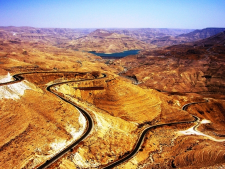
Mount Nebo is an elevated Mountain in Jordan, approximately 817 metres above sea level,.... Know More!
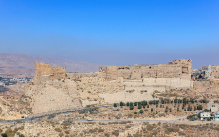
Built from the 1140s on a spur above the King's Highway, Kerak Castle is one of the largest Crusader fortresses in the Levant — and the setting for one of the strangest sieges in medieval history.
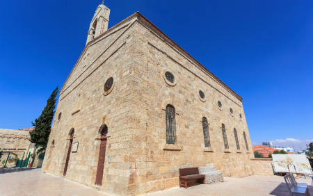
A working Greek Orthodox church in Madaba, Jordan, built in the 1890s over a Byzantine predecessor — and home to the sixth-century mosaic map of the Holy Land.

Mukawir (Machaerus) is an hour away and about 45 kms, away from Madaba on the Kings’ Highway. Know More !
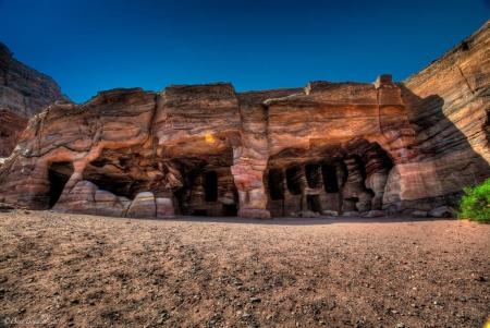
The Nabataeans (Nabateans) were an Arab people who lived in northern Arabia and the Southern Levant. They built the assumed capital city of Petra. Know more!
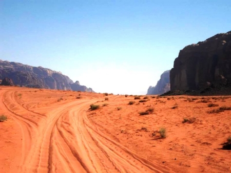
Lawrence of Arabia is a film directed by the global British director David Lean in 1962 and production of Sam Spiegel and starring Peter O'Toole role Lawrence.