Home
Home
It is a map you look down at, not up at. It has no north at the top, no consistent scale, and no straight lines to speak of. Roughly two-thirds of it is missing. And yet the Madaba Map is one of the most important documents in the study of the ancient Near East — an object that archaeologists have used, quite literally, to decide where to dig.
Made from around two million cut stones and laid into a church floor in the sixth century AD, it shows the biblical landscape as a Byzantine Christian understood it. What follows is what the map is, what it depicts, how it survived, and why fragments of a decorated floor in a small Jordanian town changed how we understand Jerusalem.
What Is the Madaba Map?
The Madaba Map is a Byzantine mosaic pavement dating to the sixth century AD, laid into the floor of a church in Madaba, Jordan, and depicting the geography of the Holy Land and its surrounding regions. It is the oldest surviving map of the region in any medium, and it is the earliest known detailed representation of the city of Jerusalem.
The mosaic sits today in the Greek Orthodox Church of St George in central Madaba, roughly 30 km southwest of Amman. The modern church was built directly over the remains of a Byzantine predecessor, and the map occupies part of what was once that older building's floor.
The essentials:
- Date: generally placed between around AD 542 and 570
- Medium: floor mosaic, made of cut stone tesserae
- Original size: commonly reconstructed at roughly 21 metres long by around 7 metres wide, though estimates vary
- Surviving portion: approximately a quarter to a third of the original surface
- Tesserae: estimated at around two million individual pieces
- Orientation: east at the top, not north
- Labels: more than 150 place names, written in Greek
- Coverage: from Lebanon in the north to the Nile Delta in the south, and from the Mediterranean coast eastwards into the desert plateau
When people search for a Madaba Jordan map, this is almost always what they mean — not a street plan of the modern town, but this pavement.
The word "map" is doing slightly unusual work here. This is not a survey. It is a picture of a landscape organised geographically, in which cities appear as small bird's-eye views of their own buildings, rivers flow with fish in them, and animals hunt in the hills. It sits somewhere between cartography and illustrated topography — closer in spirit to a medieval pilgrimage image than to anything produced by a modern surveyor.
How the Madaba Map Was Found — and Nearly Lost
The story of the map's rediscovery is not a story of archaeology. It is a story of construction work.
Madaba had been largely abandoned for centuries, its Byzantine ruins buried under soil. In 1880, Christian families migrating north from Karak resettled the ruin mound. As they built houses and cleared ground, they began encountering ancient floors beneath their feet.
In 1884, work began on a new Greek Orthodox church on the site of an earlier Byzantine one. The builders cut into the old pavement — and uncovered a mosaic covered in Greek writing and pictures of cities. Portions were damaged or destroyed during that clearance, before anyone understood what was there.
It was more than a decade before the wider world was told. In the mid-1890s the discovery was reported to the Greek Orthodox Patriarchate in Jerusalem, and by 1897 scholars had begun publishing on it. The reaction was immediate: what had been treated as decorative rubble turned out to be a unique historical document.
Damage has continued to be the map's defining problem. Fire, structural collapse in antiquity, the 1884 building works, later earthquake activity, and centuries of moisture rising through the foundations have all taken sections away. A major conservation campaign in 1965 stabilised what remained, corrected earlier distortions, and established the modern presentation of the pavement.
Because it spent its life as a floor. Floors get walked on, burned, buried under collapsing roofs, and dug through by later builders who have no idea what is underneath them. The map's losses came in layers: damage during the church's destruction in antiquity, deterioration during the long centuries of abandonment, and then a final round of accidental destruction in the 1880s when it was uncovered by people who were trying to build, not excavate. What survives is essentially the central and southern portion — enough to include Jerusalem, the Dead Sea, and a substantial stretch of the Jordan Valley, but with the northern regions largely gone.
Reading the Madaba Map: What It Actually Shows
Standing over the mosaic, the first thing to recalibrate is direction. East is at the top. The Mediterranean runs along the bottom edge. The Jordan River flows down the middle of the image from left to right, entering the Dead Sea.
Once you have that fixed, the detail opens up.
Cities appear as miniature aerial views, each with its own recognisable features — walls, gates, colonnaded streets, churches, towers. Larger and more religiously significant places get larger and more elaborate treatment.
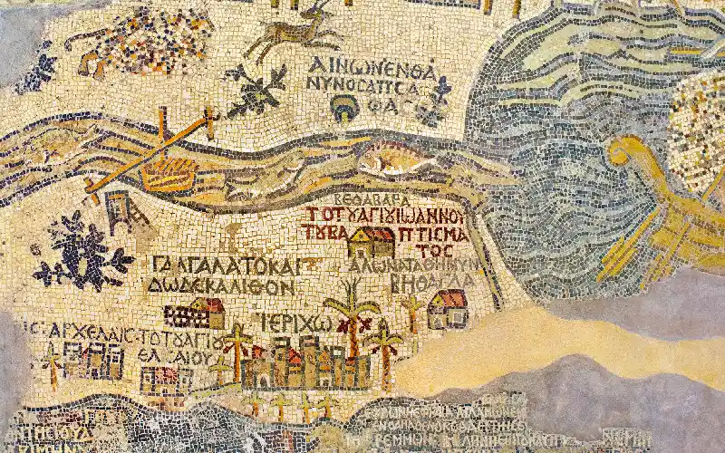
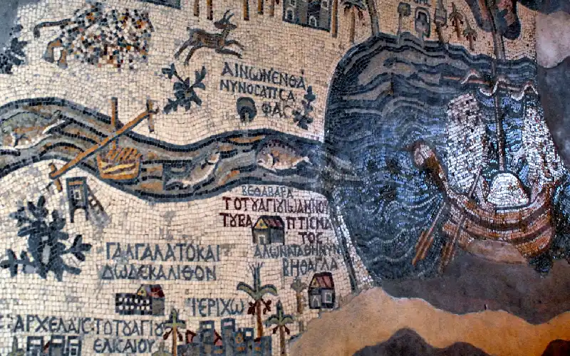
The Dead Sea is shown with two boats afloat on it, one carrying what appears to be grain or salt, the other a cargo of goods. Ancient sources record commercial traffic on the lake, and the map is a rare visual confirmation.
The Jordan River contains fish. In one of the mosaic's most quietly brilliant touches, a fish swimming downstream towards the Dead Sea is depicted turning back — an observation of the lake's lethal salinity rendered as narrative rather than as a note.
Wildlife populates the margins. A lion pursues a gazelle in the hills of Moab, east of the Dead Sea, though this section has been deliberately disrupted, its tesserae scrambled at some later point.
Vegetation marks the character of places: date palms cluster around Jericho and Zoara, signalling the oasis economy of the Jordan Valley's southern end.
Named places include Bethlehem, Gaza with its walls and public buildings, Ashkelon, Neapolis, Charachmoba on the eastern plateau, Ascalon, Jericho, Beersheba, and a long list of smaller villages, many of them otherwise obscure.
Biblical annotations run alongside the geography. Some regions are labelled with the tribal allotments of the Book of Joshua; some places carry short scriptural notes explaining what happened there. This is the layer that reveals the mosaic's real purpose.
It was made for worshippers and pilgrims, not for travellers navigating a route. Its function was devotional and educational: to place the person standing on it inside the sacred geography of scripture, and to connect biblical events to real, named, visitable locations. The heavy use of tribal allotment labels and event notes suggests it drew on written geographical reference works of the period — texts that catalogued biblical place names and identified them with contemporary settlements. In effect, the map translates a reference book into a picture you can stand on. It also served a civic purpose: a church that could show the entire Holy Land on its floor was making a statement about its own importance.
Customize Your Dream Vacation!
Get in touch with our local experts for an unforgettable journey.
Plan Your Trip
Jerusalem on the Madaba Map: The Most Important Image in the Mosaic
If the Madaba Map has a single reason for its fame, it is the depiction of Jerusalem — the oldest detailed image of the city that exists.
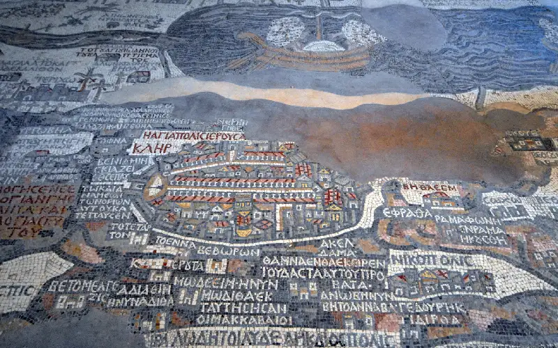
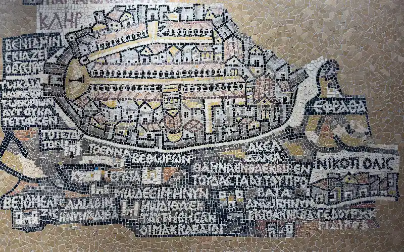
Jerusalem is rendered far larger than its true proportion, roughly oval, walled, and shown from above at an angle. The level of architectural detail is extraordinary for a floor mosaic, and individual features are identifiable:
- The city walls and gates, with towers marked along the circuit
- A large northern gate opening onto a plaza containing a free-standing column — corresponding to the gate known in Arabic as the Gate of the Column
- The Cardo Maximus, the colonnaded main street running the length of the city from north to south, shown with rows of columns and a red-tiled roof over the flanking porticoes
- A second colonnaded street running parallel to the east
- The Church of the Holy Sepulchre, depicted with steps, a basilica and a domed rotunda, drawn upside-down relative to the rest of the image so that it reads correctly to a viewer approaching from a particular side
- The Nea Church, the large Byzantine church dedicated in AD 542, shown in the southern part of the city
That last item is why the map can be dated as tightly as it is: a building dedicated in 542 cannot appear on a mosaic made before 542.
The archaeological consequences have been substantial. For centuries, the course of Jerusalem's Byzantine main street and the location of the Nea Church were matters of speculation. Excavations in the Old City during the 1970s used the Madaba Map as a working guide — and found the colonnaded Cardo and the remains of the Nea Church broadly where the mosaic indicated they should be. A sixth-century church floor in Jordan had successfully directed a twentieth-century excavation in another country.
It is inconsistent in scale and reliable in relationships. Distances are not to any fixed ratio, and importance inflates size — Jerusalem occupies a share of the surface far beyond its real footprint. But the relative positions of settlements, the sequence of places along a route, the courses of rivers, and above all the identification of ancient names with specific locations are remarkably sound. Within Jerusalem itself, the internal layout is proportionally far better than the map's overall geography, with the street grid and major buildings placed close enough to reality to have guided real excavation. The right way to judge it is not as a failed survey but as a successful index: it tells you what places were called and roughly where they sat in relation to one another, which is exactly what historical geographers need.
How the Map Was Made
The mosaic technique behind the map is the same one used across Madaba's wider corpus of Byzantine pavements, applied here at an unusually ambitious scale.
Craftsmen first prepared a layered bed: coarse rubble for drainage and stability, a thick mortar core, and a fine lime plaster setting layer on top.
Stone was then cut into small cubes, typically around a centimetre across, and considerably finer where detail demanded it. The palette came mostly from local limestone in whites, creams, greys, yellows, browns, reds and blacks, supplemented with harder or imported stone and coloured glass for the strongest hues — the blues and greens of the seas and rivers.
The design was laid out on the fresh setting bed, and tesserae were pressed in individually while the plaster remained workable. This means the floor had to be executed in sections, each completed before the mortar cured. Experienced mosaicists set their tesserae in curving lines that follow the contours of what they depict, which is why the water in the Dead Sea appears to move and why the city walls read as solid mass.
At an estimated two million pieces, the map represents an enormous investment of skilled labour — months of coordinated work by a trained team, funded by a community that considered the result worth it.
No. The map carries no signature, and no surviving inscription identifies its maker or its donor. This is normal rather than surprising — most Byzantine pavements are anonymous. What can be said with confidence is that it was produced by a local workshop tradition, because Madaba and its region contain dozens of other mosaics of comparable technique and quality from the same period, some of them dated by inscription and at least one naming its craftsman. The map was not a one-off commissioned from elsewhere; it was the high point of an established local industry that had the trained hands, the stone supply and the design capability to attempt something on this scale.
Why the Madaba Map Still Matters
Its significance runs along several independent lines, which is unusual for a single object.
As a historical source. The map preserves the sixth-century names of more than 150 places, many of them small settlements that appear in no other surviving record with this degree of locational precision. For scholars reconstructing the settlement pattern of the late antique Near East, it is a primary document.
As an archaeological tool. Very few artworks have been used to direct excavation. The map's contribution to the understanding of Byzantine Jerusalem's street plan and church buildings is a genuinely rare case of ancient art functioning as usable evidence rather than merely as illustration.
As a work of art. Separate from its documentary value, the mosaic is a sophisticated piece of design — balancing text and image, managing the transition between vast landscape and architectural close-up, and animating the whole with small observed details like the retreating fish.
As a record of how people saw the world. The map is a window into a mental geography in which theology organises space: east at the top, holy places enlarged, scripture annotated onto the terrain. It tells us not just where things were but what mattered.
As the anchor of Madaba's identity. The town's reputation as Jordan's centre of mosaic heritage rests substantially on this pavement, and the conservation and craft traditions that have grown up locally are, in part, a response to having custody of it.
Conservation remains an active concern. The principal threats to a floor mosaic of this age are moisture moving up through the substrate, salt crystallisation within the mortar bed, temperature swings, and physical wear. Modern practice favours stabilisation in place — controlling the environment, managing drainage, monitoring for movement — rather than lifting and relocating, since the pavement's relationship to its building is itself part of the evidence.
Because Byzantine Christian convention oriented images towards the east — the direction of sunrise, of Eden in Christian tradition, and of the altar in a church. A congregation facing the sanctuary faced east, so a map laid on the floor was drawn to look the same way they did. North-at-the-top is a much later European convention and was never universal.
No. Older maps survive from Mesopotamia, Egypt and the classical world, including clay tablet maps and Egyptian papyrus plans. What makes the Madaba Map unique is narrower and more specific: it is the oldest surviving map of the Holy Land, and the oldest known detailed representation of Jerusalem.
The Nile and its Delta appear in the surviving southwestern portion of the mosaic, with branches spreading towards the Mediterranean. The treatment is noticeably weaker than the map's handling of Palestine and Jordan — the river's course and the relationship between its branches are handled loosely. This is generally taken as evidence that the mosaicists were working from strong sources for the core biblical territory and much thinner information for the periphery.
Yes, on paper rather than in stone. Scholars have produced reconstructions proposing what the lost northern and western portions likely contained, based on the map's internal logic, the geographical texts it appears to draw on, and comparison with other Byzantine sources. These remain interpretive proposals. Conservation practice deliberately avoids inventing new mosaic to fill the gaps, so the pavement is presented as a fragment rather than as a completed image.
Nothing comparable survives. A small number of ancient mosaics include topographical or city-view elements, and later Byzantine and medieval works depict places symbolically, but no other surviving floor mosaic attempts a systematic geographical map of a whole region at this scale and with this density of labelled locations. The Madaba Map is, so far as the surviving record shows, unique.


Learn about Jordan attractions, ancient history, and local traditions. Find must-visit places and start planning your unforgettable experience today.
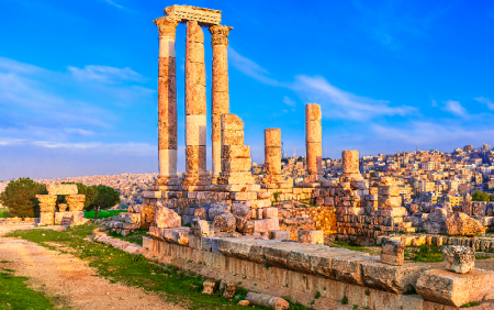
Jordan's capital and largest city, Amman spreads across a landscape of hills with a history reaching back nine millennia — from Neolithic settlement to Roman Philadelphia to modern Arab capital.
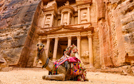
Petra is an ancient city carved into rose-red sandstone cliffs in southern Jordan, once the capital of the Nabataean civilisation and one of the most significant archaeological sites in the world — a UNESCO World Heritage Site and one of the New Seven Wonders of the World.
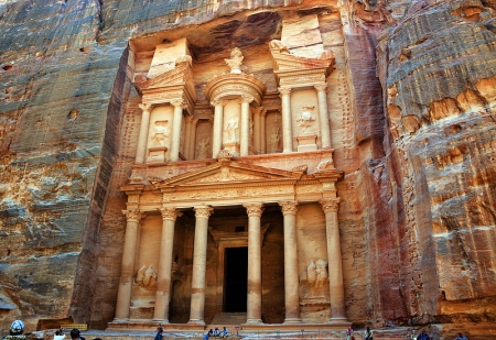
The Treasury (al-Khazneh) positioned opposite the main route into Petra. it was given by the local Bedouin tribes behind the belief that the urn on top of the front entrance contained the treasure of a pharaoh.
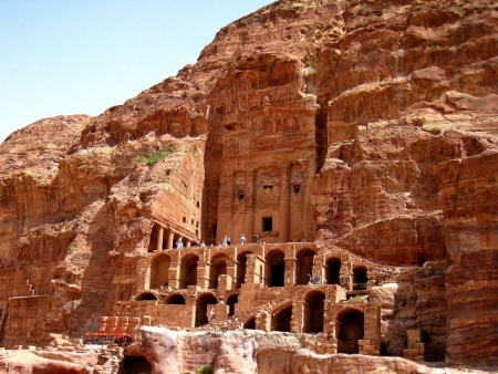
During any trip to Petra, you shouldn't miss the unpredictable Royal Tombs that took its name from the rich decoration. Know More!
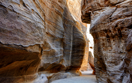
A 1.2-kilometre gorge with walls rising up to 180 metres, the Siq is Petra's main entrance — a natural rock fissure the Nabataeans turned into a processional way and a water system.
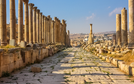
Jerash in northern Jordan is one of the best-preserved Roman cities outside Italy. A former member of the Decapolis league, it retains its colonnaded streets, temples, theatres and triumphal arches after nearly two thousand years.
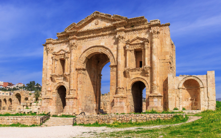
The monumental Roman gateway built to welcome Emperor Hadrian to ancient Gerasa in AD 129 — and still the most dramatic first sight in Jerash today.

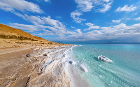
The Dead Sea is a hypersaline lake in the Jordan Rift Valley, sitting around 430 metres below sea level — the lowest point on Earth and one of the saltiest waters in the world. Its mineral-rich water and therapeutic mud have drawn health seekers for thousands of years.
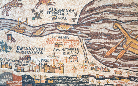
A sixth-century mosaic pavement in Madaba, Jordan, the Madaba Map is the oldest surviving cartographic image of the Holy Land — and the earliest detailed depiction of Jerusalem anywhere.
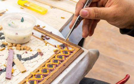
An ancient town on Jordan's King's Highway, Madaba holds the greatest concentration of Byzantine mosaics in the country — including the oldest surviving map of the Holy Land.
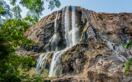
A chain of thermal waterfalls in a desert gorge below sea level, Ma'in Hot Springs has drawn bathers since antiquity — and appears on the sixth-century Madaba Map by name.
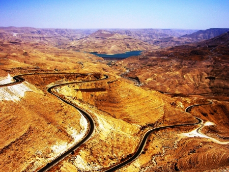
Mount Nebo is an elevated Mountain in Jordan, approximately 817 metres above sea level,.... Know More!
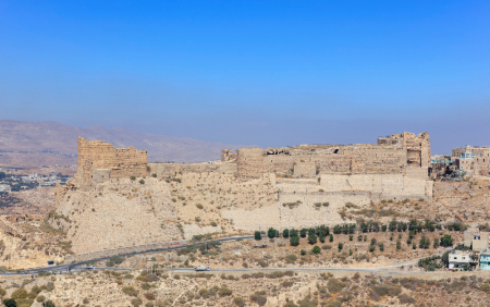
Built from the 1140s on a spur above the King's Highway, Kerak Castle is one of the largest Crusader fortresses in the Levant — and the setting for one of the strangest sieges in medieval history.
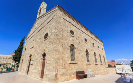
A working Greek Orthodox church in Madaba, Jordan, built in the 1890s over a Byzantine predecessor — and home to the sixth-century mosaic map of the Holy Land.

Mukawir (Machaerus) is an hour away and about 45 kms, away from Madaba on the Kings’ Highway. Know More !
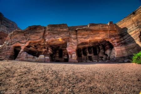
The Nabataeans (Nabateans) were an Arab people who lived in northern Arabia and the Southern Levant. They built the assumed capital city of Petra. Know more!
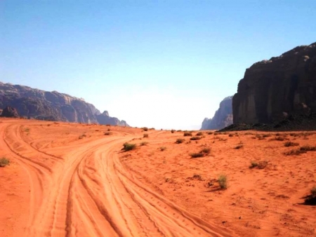
Lawrence of Arabia is a film directed by the global British director David Lean in 1962 and production of Sam Spiegel and starring Peter O'Toole role Lawrence.